Lecture: "Those Fascinating Maps" by Conservation Intern
In this time of satellites and global positioning we may be losing sight of the art and fun of reading maps. Maps were critical for navigation at sea during the age of exploration and played monumental roles in political wars over territories and expansion of empires. Maps also reflect a fascinating evolution in technical developments of accurate instruments necessary for topographical survey and mapping from the fifteenth to nineteenth centuries. And maps were all hand-made and made to be beautiful to appeal to the nobility that commissioned them and the users who bought them in book shops.
Historic Odessa Foundation has a small but notable collection of maps focusing on North America and the mid-Atlantic region. This includes maps that were collected by preservationist H. Rodney Sharp that hung in his estate “Gibraltar” in Wilmington. Among the most magnificent and earliest maps are pages from famous 17th century Dutch and German atlases.
Conservation of a dozen of these maps has been the focus of the fourth HOF summer conservation internship this year directed by HOF conservator Betty Fiske. Intern Krista Grant is a 2010 graduate in art history and fine art from the Indiana University who is gaining experience in conservation towards applying to graduate schools in art conservation.
Come hear about this interesting complex project and these wonderful maps!
The lecture will begin at 4pm and held in the Visitor's Center.
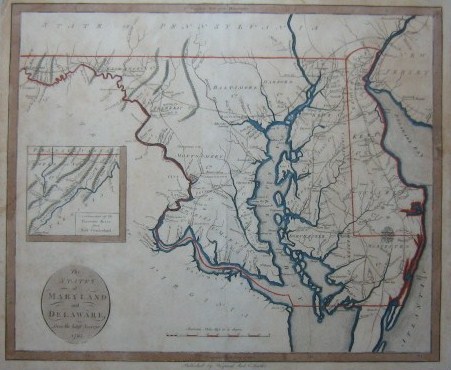
****Map of States of Maryland and Delaware from the latest surveys, 1795 published by Wayland, Reid & Smith. This photo was taken after treatment.